| Earth and Planetary Remote Sensing
|
|||||
|
Research Our research group uses remote sensing techniques, statistical methods, laboratory spectroscopy and thermal modeling to investigate planetary surface processes. Presently our research activities can be divided into three broad themes: 1) spacecraft data analysis, presently with a focus on Mars and asteroids, 2) laboratory and remote/field studies of planetary analog surfaces/materials, and 3) environmental remote sensing.
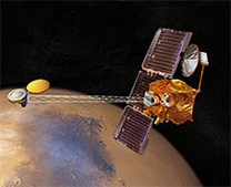
Characterizing Planetary Surfaces Using Spacecraft Data
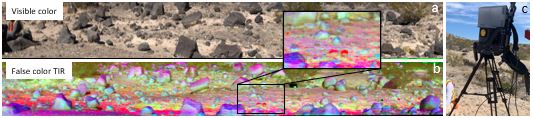
Laboratory and Field StudiesTo enhance interpretation of remotely acquired spectral and temperature measurements from planetary surfaces, we are characterizing the spectral and thermophysical properties of rocks and minerals of interest in the laboratory and conducting combined satellite-based/field-based studies of planetary analog terrains.
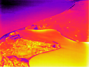
Environmental Remote Sensing Topics of interest include: Example (right):We are using aerial thermal imaging to locate potential regions of submarine groundwater discharge (SGD) into Long Island's near-shore environments. SGD brings nitrates and other nutrients into harbor waters, which feeds harmful algal blooms and disrupts natural ecosystems. In the image to the right, warm plumes represent groundwater discharging into cooler harbor waters. Aided by this imagery, Stony Brook collaborators and graduate students can better target locations to sample the chemistry and flux of groundwater discharge. © Deanne Rogers 2010-present | design by ridgehkr
|
Courtesy of Open Web Design & Best 10 Web Hosting |
| ||
 Example topics of interest include: